Lauterbrunnen Valley: The Complete 72 Waterfalls Guide
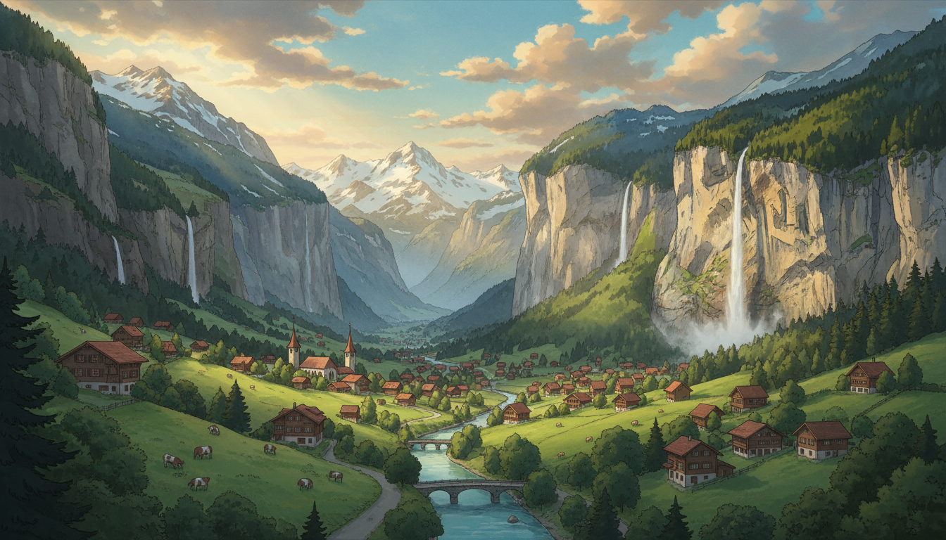
Nestled in the heart of Switzerland's Bernese Oberland, Lauterbrunnen Valley stands as one of the world's most spectacular natural wonders—a dramatic landscape where 72 waterfalls cascade down from towering cliff faces into a verdant valley below. This comprehensive guide, brought to you by Homejourney, establishes everything you need to know about experiencing this fairy-tale destination, whether you're planning a romantic getaway, an adventure-filled hiking expedition, or exploring international travel opportunities that might inspire your next property investment.
The valley's name itself tells the story: "Lauter" means loud, and "brunnen" means fountain—a fitting description for a place where the constant roar of cascading water creates a symphony of nature. With waterfalls ranging from delicate mists to thunderous 400-meter plunges, Lauterbrunnen Valley offers an unparalleled experience that has inspired travelers, artists, and dreamers for generations.
Table of Contents
- Valley Overview & Geography
- The 72 Waterfalls: Complete Breakdown
- Staubbach Falls: Switzerland's Third-Highest Waterfall
- Trummelbach Falls: Europe's Largest Underground Waterfalls
- Villages & Towns in the Valley
- Comprehensive Hiking Guide
- Best Time to Visit
- Where to Stay
- Practical Travel Information
- Suggested Itineraries
- Lauterbrunnen Valley & Singapore Property Investment
- Frequently Asked Questions
Valley Overview & Geography
Lauterbrunnen Valley stretches approximately 15 kilometers through the Bernese Oberland, a UNESCO World Heritage Site that encompasses the Jungfrau region. The valley's dramatic geology was shaped over millennia by glacial meltwater carving through limestone and sandstone, creating the sheer cliff faces from which the famous waterfalls descend.[1]
The valley floor sits at approximately 800 meters elevation, while the surrounding peaks reach heights of 2,000-4,000 meters. This significant elevation change creates the perfect conditions for waterfalls: abundant glacial meltwater from peaks like the Jungfrau (4,158 meters) and consistent precipitation throughout the year ensure that water flows continuously through the valley.[3] The meltwater volume is staggering—20,000 liters per second of glacier water rushes through the valley's waterfall systems, carrying with it over 20,000 tonnes of debris and creating the distinctive milky-blue color of the valley's rivers.[4]
The valley comprises five main towns and villages: Lauterbrunnen (the main village and gateway), Wengen, Mürren, Gimmelwald, Stechelberg, and Isenfluh.[1] Notably, three of these villages—Wengen, Mürren, and Gimmelwald—are entirely car-free, accessible only by gondola or on foot, preserving their authentic alpine character and creating an immersive natural experience.[1]
Understanding the 72 Waterfalls: Complete Breakdown
The number "72" has become iconic for Lauterbrunnen Valley, but understanding what this figure actually represents is crucial for visitors. The 72 waterfalls exist simultaneously during the year, flowing at any given time depending on seasonal water availability and weather conditions.[1] However, this doesn't mean you'll see all 72 at once—many are positioned on opposite sides of the valley, hidden behind rock formations, or visible only from specific vantage points.[7]
The waterfalls vary dramatically in size and character. Some of the most prominent include:
- Mürrenbach Falls – The highest waterfall in the entire valley
- Buchenbach Falls – The second-highest waterfall
- Staubbach Falls – Switzerland's third-highest waterfall at nearly 300 meters
- Trummelbach Falls – A system of 10 waterfalls hidden within the mountain
- Mürrenbachfall – Another spectacular cascade along the hiking routes
The waterfalls are uniquely formed by meltwater from the Jungfrau glacier flowing down slot canyons, which has sculpted the canyon walls over thousands of years.[3] This geological process continues today, with the powerful water flow constantly reshaping the landscape. The sheer volume of water means that even during drier months, the valley maintains its characteristic waterfalls—a testament to the region's abundant precipitation and glacial melt.
Staubbach Falls: Switzerland's Third-Highest Waterfall
Staubbach Falls is arguably the most iconic waterfall in Lauterbrunnen Valley, and for good reason. Rising nearly 300 meters (approximately 984 feet) from the cliff face, this waterfall is immediately visible from Lauterbrunnen village and serves as the valley's most recognizable landmark.[3][5]
The name "Staubbach" translates to "dust stream," referring to the unique characteristic of this waterfall: during windy conditions, the water breaks apart into a fine mist before reaching the valley floor, creating a ethereal, dust-like effect rather than a solid stream. This phenomenon makes Staubbach Falls particularly photogenic and creates an otherworldly atmosphere, especially during summer months when warm air currents carry the mist across the valley.[5]
Visiting Staubbach Falls: The hike to and behind Staubbach Falls is one of the most accessible waterfall experiences in the valley. The trail is suitable for families and beginners, though certain sections pass through rock caves that can be slippery, particularly after rainfall or during winter months.[6] The hike takes approximately 1-2 hours round trip from Lauterbrunnen village, and hikers can actually walk behind the waterfall curtain—a thrilling experience that brings you face-to-face with the power of falling water.[5]
The trail offers multiple vantage points for photography and contemplation. The most popular spot, often called the "money shot" by locals, provides a framed view of Staubbach Falls with the village church in the background, creating the quintessential Lauterbrunnen Valley image.[8] This location is particularly stunning during golden hour (early morning or late afternoon) when the light catches the mist and creates rainbow effects.
Trummelbach Falls: Europe's Largest Underground Waterfalls
While Staubbach Falls captivates with its height and visibility, Trummelbach Falls impresses with raw power and dramatic geology. This system of 10 waterfalls cascades through tunnels and caverns carved into the mountainside, making it Europe's largest underground waterfall system.[4][6]
The falls plunge over a combined height of 140 meters through a labyrinth of underground passages.[7] What makes Trummelbach Falls truly extraordinary is the sheer violence of the water flow. The 20,000 liters per second of glacier meltwater thunders through the caverns with such force that the entire mountain visibly rumbles and vibrates—an experience that cannot be fully appreciated from photographs or descriptions alone.[4][6]
Visiting Trummelbach Falls: Access to these underground waterfalls is managed through a sophisticated system of walkways, stairs, and even an elevator that takes visitors up to a point between the 6th and 7th waterfall.[3][6] This engineering allows visitors to experience the falls from multiple perspectives and angles, each offering unique views of the cascading water and the cavern formations.
The visitor experience at Trummelbach Falls typically takes 1-1.5 hours. Visitors enter through a tunnel entrance and progress upward through the mountain, encountering each waterfall in sequence. The elevator ride itself is an attraction—it ascends through the mountain, offering an intimate sense of the geological forces at work. The combination of mist, sound, and the tactile sense of the mountain's vibration creates an unforgettable sensory experience that distinguishes Trummelbach Falls from any other waterfall destination.[6]
The waterfall is located approximately halfway along the Lauterbrunnen to Stechelberg hiking trail, making it an ideal stopping point for hikers. An admission fee applies (approximately CHF 12-15), and the falls are accessible year-round, though water flow is most dramatic during spring and early summer when glacial melt is at its peak.
Villages & Towns: Exploring the Valley's Communities
Lauterbrunnen Valley's charm extends beyond its waterfalls to the distinctive villages that dot the landscape, each offering unique character and experiences.
Lauterbrunnen Village
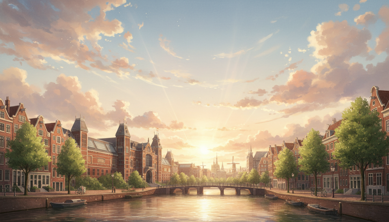
The main village serves as the valley's gateway and primary hub for tourists. Situated on the valley floor, Lauterbrunnen offers excellent transportation connections, accommodations, restaurants, and the tourism office where visitors can obtain detailed hiking maps and local advice.[1] The village maintains authentic Swiss alpine character despite its tourist infrastructure, with traditional chalets and a working agricultural community. The village church provides a picturesque focal point and appears in countless photographs of Staubbach Falls.
Wengen
Perched high above the valley at approximately 1,274 meters elevation, Wengen is accessible only by cable car or hiking trail—no vehicles are permitted.[1] This car-free status preserves the village's tranquil, authentic atmosphere. Wengen offers stunning panoramic views of the valley and serves as an excellent base for hiking to Mannlichen, a mountain with spectacular vistas of the entire Lauterbrunnen Valley.[2]
Mürren
Another car-free village, Mürren sits at 1,638 meters and is famous as the location of the Schilthorn Peak (10,000 feet), which was featured in the James Bond film "On Her Majesty's Secret Service" under the fictional name "Piz Gloria."[1][4] The Schilthorn offers 360-degree panoramic views of the surrounding Alps, and the rotating restaurant at the summit provides a unique dining experience with views extending across multiple countries on clear days.
Gimmelwald
The smallest and most remote of the car-free villages, Gimmelwald maintains an intensely rural character with traditional farmhouses and grazing cows. The village offers authentic alpine experiences and serves as a quieter alternative to busier tourist destinations, appealing to travelers seeking solitude and genuine mountain village atmosphere.
Stechelberg & Isenfluh
Stechelberg, located at the southern end of the valley, serves as a transportation hub with cable car access to Mürren and Schilthorn. Isenfluh, perched on the eastern valley wall, offers spectacular views and a more secluded experience while remaining accessible by road and hiking trails.
Comprehensive Hiking Guide: Trails & Routes
Lauterbrunnen Valley is a hiker's paradise with trails ranging from easy valley walks to challenging alpine routes. The valley's water sources make it unique—hikers can refill water bottles from fresh mountain streams approximately every half-kilometer, with some adventurers simply drinking directly from the waterfalls.[1]
Classic Route: Lauterbrunnen to Stechelberg
This 8-kilometer trail is the most popular and accessible hiking route in the valley.[4] The hike takes approximately 2 hours and ascends 161 meters, making it suitable for most fitness levels. The route follows the valley floor along the Lütschine river, passing numerous waterfalls and offering constant visual interest.[4]
Route highlights:
- Start in Lauterbrunnen village
- Pass Staubbach Falls and multiple smaller waterfalls
- Reach Trummelbach Falls (approximately halfway, with entrance fee required)
- Continue past Mürrenbachfall (highest waterfall in the valley)
- Follow the icy-blue Lütschine river to Stechelberg
- Option to take cable car back to Lauterbrunnen or continue hiking
This route is best completed in the morning to maximize daylight and avoid afternoon crowds. Proper hiking boots are essential due to steep elevation changes and potentially slippery sections.[1] The trail is well-marked and maintained, with signage in German and English.
Wengen Routes
From Wengen, hikers can access Mannlichen, a mountain offering stunning panoramic views of the entire Lauterbrunnen Valley.[2] The hike to Mannlichen's summit takes approximately 2-3 hours from Wengen and rewards hikers with 360-degree views of the surrounding peaks and valleys. On clear days, visibility extends across the entire Bernese Oberland.
Schilthorn & Mürren Routes
The Schilthorn Peak (10,000 feet) offers the most dramatic views in the region. While cable cars provide access, hiking routes also connect Mürren to the summit. The hiking route takes 2-3 hours and ascends through alpine meadows and past numerous viewpoints. The summit's rotating restaurant and 007 connections make this a must-visit destination.
Grindelwald Connection
From Lauterbrunnen, hikers can access Grindelwald, another spectacular valley in the Jungfrau region. The First